The Frying Pan, 20 Aug 1877
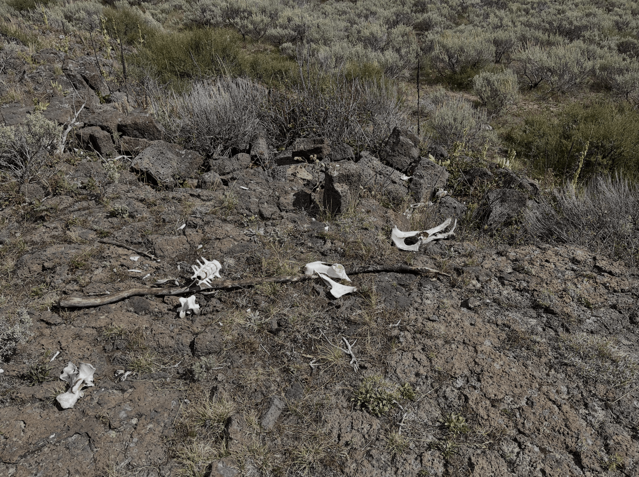
On 14 Sep 2026, I hiked to this spot maybe 3/4 of a mile from an interpretive center just off Idaho road A2. I walked down the two dirt vehicle tracks without knowing where they would lead or what would be there.
The road took me right to the Frying Pan skirmish site. In a vehicle with reasonable clearance you can drive right to it.
During the Nimiipuu (Nez Perce) flight of 1877, native warriors fought a series of delaying actions to keep the US troops at distance as they fled to Canada. Although soldiers are warriors, and the Nimiipuu were part-time soldiers, for simplicity’s sake I’ll use “NPs” or “warriors” to refer to the natives in this article. “Soldiers” will mean the US troops.
The night (or should I say, the very early morning) before the Frying Pan skirmish, warriors raided the US camp in Camas Meadows (now located on private property and inaccessible) to steal horses. It was not for financial gain. Their main goal, according to Yellow Wolf, was to slow down the troopers chasing them.
Taking possession of the horses increased NP mobility and food supplies (before refrigerators, a horse, mule or cow was a mobile, single-use meat locker) while at the same time reducing the mobility of the US troops. The NPs ran off with many head of livestock, most of which turned out to be mules in the morning light.
Companies B, I, and L (about 50 men each) were ordered to take back the animals (the 1870s US equivalent of captured vehicles). They caught up after about five miles, at the place I hiked to.
The soldiers dismounted and a 4-hour fire fight ensued. Companies B and I retreated but Company L, under captain Randolph Norwood, became encircled and dug in.
Where they dug in is still visible today. Some Boy Scouts set up interpretive markers as an Eagle project (the two signs in the photo below; where the triangle is in the site map below that).
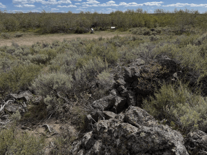
I was unable to photograph those markers up close, as my iPhone has reached its preplanned obsolescence date, and my battery died. One marker (the sign on the right above) has an excellent layout of the DFPs, defensive fighting positions. I found the same diagram on nezpiercetrail.net. I’ll call the positions as a whole a “perimeter,” although it was more a smattering of necessity than a circular or oval perimeter.
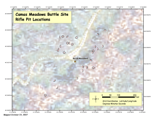
The current parking lot off A2 is to the northeast (up and right), well off this diagram.
These days, for a planned defense, a fire team or squad leader might walk the terrain, telling soldiers where to set up their fighting positions (particularly crew-served weapons). I doubt much if any of that happened here, as the defense was probably not planned. I’m guessing soldiers set up more or less where they found themselves pinned down.
Gone were the pre-Wagon Box Fight and pre-Beecher Island days of riding in a circle around the US troops, shooting arrows till the soldiers had expended their first rounds and were muzzle loading. The US troops probably had single shot breech-loading carbines, Springfields or Spencers, or rifles. The NPs had some of those, and also very handy Winchester or Henry lever-action, magazine fed, repeating carbines.
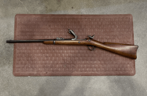
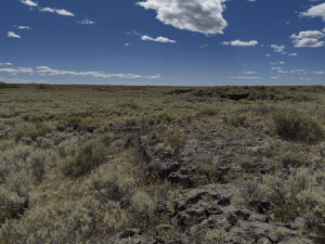
The battle took place on a lava field. The terrain is mostly rocky, and no doubt was back then. Today it is covered by scattered scrub. There are some small trees in the middle by the road. The trees (or thair ancestors) may or may not have been there, but the vegetation was probably similar in 1877. The DFPs remain, as they consisted mostly of circular, oval, and semi-circular cairns of volcanic rock laid out on the hard, barren volcanic substrate.
It’s possible that the Boy Scouts re-built the cairns, but I doubt it. There’s no reason I can think of that anyone would have made the effort to move or scattered them over the last century and a half. I’m fairly certain the piles of rock you see here were the ones put built by soldiers under fire in 1877.
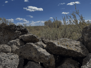
Some of the pits seemed smallish for an adult, but men were probably shorter in the 19th Century.
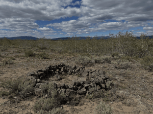
It was probably warm that August day in the flatlands of SE Idaho. The soldiers in wool uniforms, on their bellies on lava rock, called it “The Frying Pan.”
The low (about 1 foot high) walls of igneous rock around each DFP did not offer much protection, even when prone. Rolling up on one’s side to access ammo in a belt pouch would’ve exposed the US soldiers’ shoulders as they rolled. Although the soldiers were issued spade bayonets (about the size and shape of a garden trowel), it was difficult if not impossible to dig rifle pits, much less trenches. The DPFs were what I used to call a “hasty scrape” when I was a rifleman.
Some of the low stone walls were complete circles (or ovals), protecting from the rear as well as the front and sides. Others were horseshoe shaped. While lacking rear protection, it was possible to back out of the horseshoes on one’s belly, without raising one’s self up enough to clear the foot-high parapet.
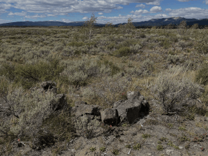
In the image above, this half-circle of stones southwest of the interpretive markers (triangle on the map) is set up where the “back door” allows access to and from the pit from that shallow watercourse behind, without exposing the soldiers to NP fire from south of their positions.
The position shown below, east of the DFP shown above, was on the southeast side of the perimeter. Like the DFP above, it was only a half circle, offering little protection to the front, less to the sides, and none to the rear. Unlike the position above, it stuck out “like a dog’s balls” (as one British Falklands vet put it) and offered no escape or covered route for aid.
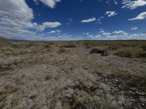
I’m guessing whoever built the DFP above was pinned down in the open and rather than crawling back to the cover of the slightly folded terrain below simply started grabbing whatever rocks were nearby and piling them between him and the NP fire. He probably would’ve built a more encompassing (and higher) parapet if he’d had more rocks to hand.
The position below was set up on the forward slope of a very, very low rise. It was properly placed on the “military crest,” near but not at the top of the rise.
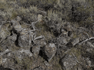
If it had been at the top of the rise, the soldier might’ve had a slightly (but not much) better view of his battle space, but his head would’ve been silhouetted against the skyline behind. If memory serves, it was on the northwest part of the perimeter.
Eventually, the NPs broke contact and linked up with the rest of their people. The US troops, with one KIA, two mortally wounded, were forced to seek medical aid for several other casualties and to procure more pack animals, so they were unable to continue the pursuit for some time. The Nimiipuu moved east across Yellowstone National Park and then north en route to Canada. Some made it.
Nimiipuu is a word meaning “people” and if I interpret what I’ve read correctly, is not properly capitalized when used to refer to persons in general. I’ve capitalized it here to show respect to a specific set of people who use that spoken language.